GARMIN inREACH SE®+ SATELLITE COMMUNICATOR

11-11425
AUD$722.00

Handheld Satellite Communicators with GPS Navigation

    100% global Iridium satellite coverage enables 2-way text messaging from anywhere (satellite subscription required).
    Trigger an interactive SOS to the 24/7 search and rescue monitoring center.
    Track and share your location with family and friends.
    Pair with mobile devices¹ using the free Earthmate® app for access to downloadable maps², U.S. NOAA charts, color aerial imagery and more.
    inReach Explorer+ device adds preloaded DeLorme® TOPO maps with onscreen GPS routing plus built-in digital compass, barometric altimeter and accelerometer.
You may venture off the grid, but you’re never out of reach – as long as you’re carrying an inReach SE+ or inReach Explorer+. These handheld satellite communicators are designed for the outdoor enthusiast who wants to roam farther and experience more – without compromising their loved ones‘ peace of mind. From backcountry experiences to international adventures, inReach provides communication, location sharing, navigation and critical SOS functions for anyone who loves getting away from it all, on land, water or in the skies.

Explore Anywhere. Communicate Everywhere.
    Using the worldwide coverage of the Iridium satellite network, these go-anywhere portable devices let you exchange text messages with any cell phone number or email address anywhere – while using GPS to track and share your journey’s progress. You can also post to social media or even communicate inReach-to-inReach in the field.

    In case of an at-risk situation, you can also use inReach to trigger an SOS to the 24/7 monitoring center, text back and forth about the nature of your emergency, and receive confirmation when help is on the way.
No Cell Tower? No Phone Service? No Problem.
    inReach SE+ and Explorer+ give you all the tools to stay totally connected. You don’t have to worry about being within range of a cell tower – or encountering spotty coverage in fringe zones or blackout areas. Your inReach communicator works anywhere and everywhere – so you’re never out of range, never out of reach.
Track and Share Your Whereabouts
    Turn on the tracking function of your inReach SE+ or Explorer+ communicator, and let family and friends follow your progress on their computers or mobile devices, using the web-based MapShare® portal. The inReach device will send waypoints at preselected time intervals, so followers can track your whereabouts online. You can also invite your crew back home to use MapShare to ping your inReach unit and see your GPS location, track your movements and exchange messages during your trip. You can even embed your MapShare page on a blog, website or social media.
Pair with Your Mobile Device
    For even more capability and convenience, the free Earthmate® app syncs your inReach handheld via Bluetooth® with your compatible Apple® or Android™ device¹ so you can access unlimited maps, aerial imagery and U.S. NOAA charts. Plus, Earthmate allows you to conveniently use all of the inReach features on your paired mobile device. For easier messaging, you can also sync your inReach device with your phone’s contact list to reach anyone, anywhere – with fewer keystrokes.
Get Weather Wherever
    The optional inReach weather forecast service provides detailed updates directly to your inReach device, compatible smartphone or tablet paired with the Earthmate app, so you’ll know what conditions to expect en route. Basic and premium weather packages are offered. And you can request weather forecasts for your current location or any other waypoint or destination on your itinerary.
Who Will Answer Your SOS? GEOS Will.
    GEOS is the world leader in emergency response solutions and monitoring. They’ve supported rescues in more than 140 countries, saving many lives in the process. And they’re standing by 24/7/365 to respond to your SOS, track your device and notify the proper contacts and emergency responders in your area. Then, while help is on the way, GEOS will continue to text back and forth with you, providing updates and critical information until your situation is resolved.
Affordable, Flexible Satellite Airtime Plans
    To access the Iridium network and communicate with your inReach SE+ or Explorer+ device, an active satellite subscription is required. Depending on your usage level, you can opt for an annual contract package or flexible month-to-month airtime plan.
Unlimited Cloud Storage and Trip Planning are Included
    Every inReach device comes with free access to a cloud-powered portal to plan your trips with routes and waypoints, create preset messages and quick texts, sync and manage your device settings, update your firmware, download additional TOPO maps, link your social media accounts, store all your location tracking data and much more.
Built for the Rugged Backcountry
    Tough, durable, impact resistant and water-rated to IPX7, the inReach SE+ and Explorer+ handhelds are built to keep you up and running – no matter what the elements throw at you. An internal, rechargeable lithium battery comes standard on both units so you can count on long battery life in every mode of operation (up to 100 hours at 10-minute tracking mode (default); up to 75 hours at 10-minute tracking with 1-second logging; up to 30 days at the 30-minute interval power save mode; and up to 3 years when powered off). Recharge via the standard microUSB power cable or optional in-vehicle 12 V charger.

addthis


FEATURES

  • Bluetooth® connectivity to Garmin Pilot™ and more
  • Trigger an interactive SOS with 24/7 search and rescue monitoring center
  • Send and receive text messages to SMS and email
  • Send and receive messages with other inReach users; exchange locations
  • Request weather forecasts for current location and planned destination
  • Virtual keyboard for custom text messaging
  • Send waypoints to MapShare™ portal during trip
  • Send route selection to MapShare portal for friends and family to see progress
  • Track and share location with friends and family on web-based MapShare portal
  • 100% global Iridium satellite coverage
  • Pair with mobile devices operating the free Earthmate® app for access to downloadable maps, U.S. NOAA charts, color aerial imagery and more

SPECIFICATIONS

  • Physical dimensions: 2.7" x 6.5" x 1.5" (6.8 x 16.4 x 3.8 cm) with keypad and SOS door bump
  • Display size: 1.4" W x 1.9" H (3.5 x 4.7 cm); 2.31" diag (5.9 cm)
  • Display resolution: 200 x 265 pixels
  • Display type: Transflective color TFT
  • Weight: 7.5 oz (213.0 g)
  • Battery: Rechargeable internal lithium ion
  • Water rating: IPX7
  • High-sensitivity GPS receiver: Built-in
  • Interface: USB
  • Cloud storage: Unlimited
  • Battery life: Up to 100 hours at 10-minute tracking mode (default); up to 75 hours at 10-minute tracking with 1-second logging; up to 30 days at the 30-minute interval power save mode; and up to 3 years when powered off


CAPABILITIES

  • Take Flight with Unique Aviation Capabilities
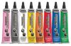
    • Garmin Pilot™ version 8.6 integrates with inReach devices to send and receive text messages over a Bluetooth® connection with the latest version of Garmin Pilot. You can also sync Garmin Pilot with your phone’s contact list to reach family and friends without cellular reception. Additionally, inReach satellite communicators are a supported device for the Lockheed Martin Flight Services (LMFS) Adverse Condition Alerting Service (ACAS), Surveillance-Enhanced Search and Rescue and Enhanced Special Reporting Services (eSRS).
  • Low-cost Service Options
    • To access the Iridium network and communicate with inReach SE®+ or Explorer®+, an active satellite subscription is required. Depending on usage level, users can opt for an annual contract package or a flexible month-to-month airtime plan, which allows them to pay for service only when they need it. Annual plans range from $11.95 to $79.95 per month (plus activation fee), and month-to-month plans range from $14.95 to $99.95 per month. Please see the attached subscription plan page for more details on U.S. monthly plan prices.
  • Explore New Places with Peace of Mind
    • Tough, durable, impact resistant and water-rated to IPX7, the inReach SE+ and Explorer+ handhelds are built to keep you up and running. For even more capability and convenience, the free Earthmate® app syncs your inReach handheld via Bluetooth® with your compatible Apple® or Android™ device so you can access unlimited maps, aerial imagery and U.S. NOAA charts. The optional inReach weather forecast service provides detailed updates directly to your inReach device, so you’ll know what conditions to expect en route.


CLICK HERE FOR inReach™ RATES and FLEXIBLE PLANS TO SUIT EVERYONE
No recommended products at the moment.